
Ruta 40: Cycling Argentina’s Most Legendary Road
I cannot speak for the entire length of Ruta 40 — it runs for thousands of kilometers through Argentina and I have only ridden a portion of it. But the stretch from the Bolivian border down to the Paso Agua Negra turnoff is reason enough to make the trip.
The Route
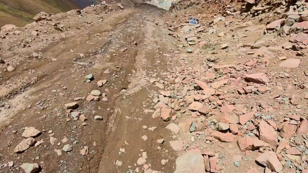
My ride started at the Bolivian border and ended roughly 1,500 kilometers later at the junction for Paso Agua Negra. The northern section is almost exclusively gravel for the first 800 kilometers — sometimes rough, sometimes winding through river canyons with official signs warning that certain sections are impassable after rain.
That warning is worth taking seriously. One night I was caught by rain, and several river crossings the following morning required stopping, wading through, and getting wet feet regardless. Nothing dangerous, but worth knowing before you go.
Further south the road transitions through the wine regions around La Rioja and into drier desert landscapes. The variety within a single route is remarkable — few roads change character this dramatically over a comparable distance.
Road Conditions
The first 800 kilometers are gravel. Quality varies — some sections are smooth and fast, others rougher with loose surface or embedded rocks. The river canyon sections are the most technical, particularly after rain.
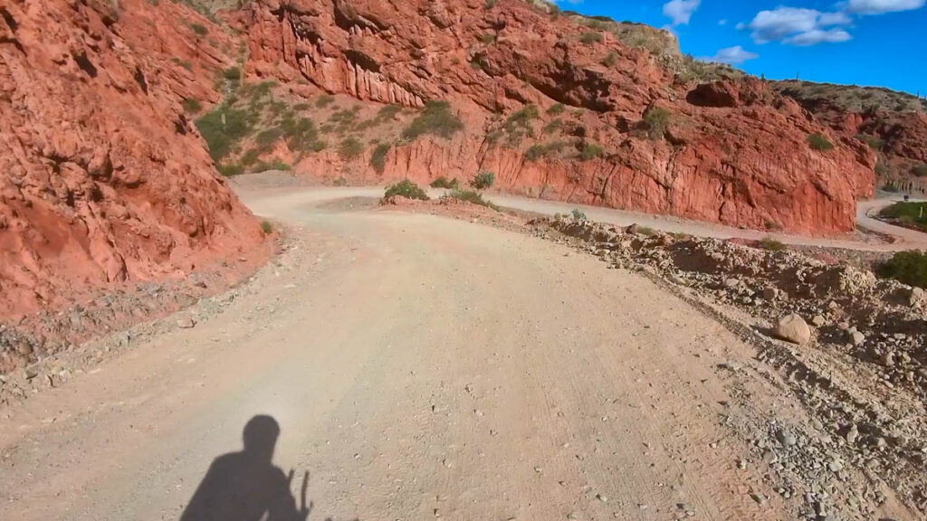
From the wine regions southward the road improves and larger towns become more frequent.
Best Time to Go
I arrived from Bolivia at the end of March and reached the Paso Agua Negra junction in early April. Night temperatures were still above freezing throughout. The latest I would recommend arriving at the Paso Agua Negra junction is early April — after that temperatures drop significantly and high passes become unreliable.
For the Paso Agua Negra crossing, current road conditions can be checked at aguanegra.sanjuan.gob.ar — worth doing before committing to that section.
Altitude
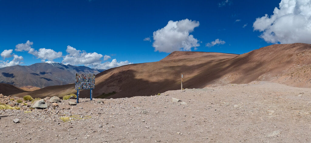
The northern section reaches significant elevation. The Abra del Acay pass sits at 4,972 meters — one of the highest unpaved mountain crossings in the region. Anyone who knows their body handles altitude poorly should plan accordingly: above 3,000 meters, limit daily elevation gain and give yourself time to acclimatize.
The high altitude also means intense sun exposure. UV radiation at elevation is significantly stronger than at sea level and should not be underestimated — sunscreen, lip protection and proper eye protection are essential, even on overcast days.
Money and Supplies
Cash is essential on this route. ATMs are sparse in the north and not always reliable even when present. If coming from Bolivia, it is worth exchanging money on the Bolivian side before crossing — rates tend to be more favorable and options more plentiful.
Further south in the wine regions, larger towns have ATMs and Western Union branches, though these are also not guaranteed to have cash available.
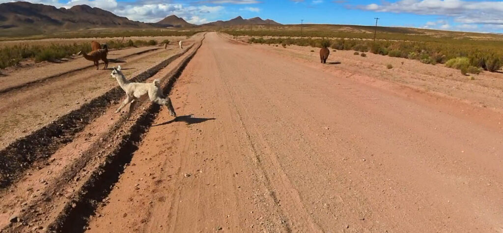
Accommodation exists along the route but gaps between options can be significant. By bicycle, wild camping is possible almost everywhere in the north — the terrain and low population density make it straightforward.
Language
English is rarely understood along this route. Basic Spanish makes a meaningful difference — not just for practical communication but for the interactions that make a long ride memorable.
Practical Notes
- Start: Bolivian border
- End covered: Paso Agua Negra junction (~1,500 km)
- Surface: Gravel for first ~800 km, improving further south
- Best timing: Arrive at Paso Agua Negra no later than early April
- Altitude: Reaches 4,972m — know your limits above 3,000m
- Sun protection: Essential at elevation — sunscreen, lip protection, eye protection
- Cash: Carry enough — ATMs unreliable in the north
- Wild camping: Possible almost everywhere in the north
- Language: Basic Spanish strongly recommended
For more long-distance cycling routes worth planning a trip around, see Roads Worth a Journey.