Navigation & Apps for Long-Distance Cycling
These are the cycling apps and tools I rely on for long-distance touring — tested across multiple continents and thousands of kilometers.
Here’s my current selection of useful apps for long-distance bikepacking and cycle touring:
Table of Contents
Navigation
I do not use a dedicated GPS device for navigation. Over time I have built a setup on my phone that I have grown so accustomed to that switching would feel like a step backwards. The level of configurability — particularly with BRouter for routing and OpenAndroMaps for map data — is something I have not found matched by any dedicated cycling computer or GPS unit.
The biggest practical disadvantage of using a phone is operability in bad weather. Touchscreens become unreliable with wet fingers or in heavy rain — and that is where dedicated navigation computers have a clear advantage. For anyone riding in consistently wet climates this is worth factoring into the decision.
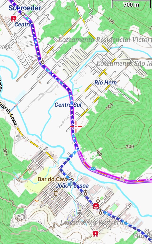
Locus Map + OpenAndroMaps + BRouter
These three apps work together as a complete offline navigation system — and in combination they cover everything I need for long-distance cycling.
Locus Map is the main navigation app. It supports a wide range of maps and routing engines, which is why it works so well as the central hub. The free version is fully functional but comes with a small banner ad at the top and — in the current version — requires unlocking the screen manually when switching it back on, which was free in earlier versions but is now a premium feature. One feature I particularly like is the ability to overlay elevation gradients in colour on a loaded track. A detailed full elevation profile is unfortunately also restricted to the paid version.
OpenAndroMaps provides the map data. It is a carefully processed version of OpenStreetMap data, available for download by country or region for offline use. The visual quality of the maps is excellent — there are several styles available including City, Cycling and Hiking. Within Locus, you can also configure exactly which categories of points of interest are displayed, which keeps the map clean and relevant.
When Locus Maps is installed you can select a map on openandromaps.org and just click on a button to install the map in Locus Map.
BRouter handles the routing. It is a fully configurable offline routing engine — you download the routing data for the areas you need, and it works entirely without an internet connection. Several ready-made profiles are available for different use cases, but the configuration can also be done completely by hand if you want full control.
After brouter is installed you have to select it in Locus Maps to use it as the default routing tool.
Points of Interest & Camping
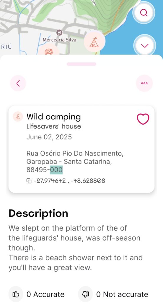
iOverlander
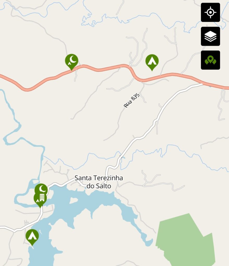
As the name suggests, iOverlander is built specifically for overlanders. Community-contributed points are marked on a map across categories including campsites, wild camping spots, ATMs and currency exchange offices. What makes it more useful than standard map apps is that most points include descriptions and photos tailored specifically to overlanders — whether by car, camper, motorbike or bicycle. Points can be downloaded for offline use. The free version is limited to one country at a time, which means deleting the current download before loading a new region.
Rolling Around
Essentially the same concept as iOverlander but focused specifically on cycle tourers. It exists largely because iOverlander was originally free and then introduced a premium model — Rolling Around filled the gap. In practice there is some overlap, but occasionally one has points the other does not. For most situations it adds overhead rather than value, but worth having installed as a backup.
Weather
Windy
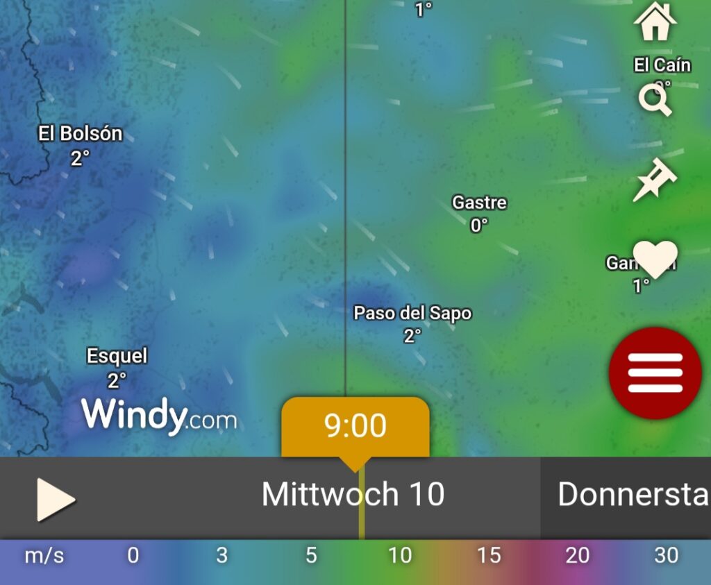
The most useful weather app for long-distance travel. Wind forecasts in particular are far more detailed and reliable than standard weather apps — which matters considerably when planning daily distances on exposed routes.
One particularly useful feature is the ability to compare different forecast models side by side. Seeing where models agree or diverge gives a sense of how reliable the current forecast actually is — useful when making decisions about exposed mountain crossings or long exposed sections.
Multiple data layers can be overlaid on the map. I regularly use dew point, accumulated precipitation over 12 hours and wind direction — the combination gives a much clearer picture of what conditions are actually developing than a simple forecast summary.
Translation
Google Translate
The offline language packs make this genuinely useful in areas without connectivity. Downloading packs for the countries ahead is worth doing while you still have a reliable connection.
With an internet connection the speech recognition works well and speeds up communication considerably. Worth noting that not everyone is familiar with the concept — in China, for example, many people will pull out their own phone and use speech recognition themselves to communicate with you, which makes the exchange surprisingly natural.
Accommodation
Warmshowers
A community platform connecting cycle tourers with hosts willing to offer a place to sleep, a shower and often a meal. The community tends to be genuinely welcoming — most hosts are cyclists themselves and understand what long-distance travel involves. Warmshowers was originally free and built entirely on community goodwill. It has since introduced a paid membership model. Still worth having — the community remains active and the concept unchanged — but worth knowing before you sign up.
Booking.com / Hostelworld Agoda etc.
Standard options for nights when a proper bed is needed. Always compare prices.
Taxi Apps
For getting to and from airports or bus stations with a boxed bike, taxi apps are worth having — see the Transportation page for an overview of which apps work where.
Country-Specific Apps
Some regions require a completely different set of tools. The apps that work everywhere else may not work at all, and the local alternatives are often surprisingly capable.
China

China feels like a different internet. Many standard apps — including Google Maps, WhatsApp and large parts of the western app ecosystem — are blocked or non-functional without a VPN. If you are using a local SIM card, expect significant restrictions. An eSIM with a breakout point outside China keeps your usual apps accessible and avoids most of these issues entirely.
For everything else, the following apps are essential:
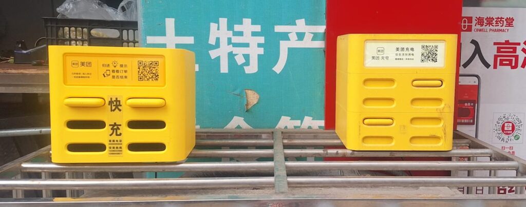
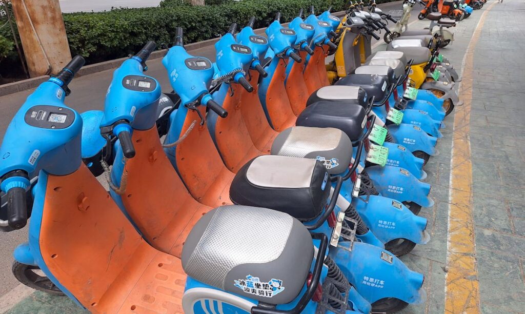
WeChat is the most widely used app in the country and functions as a complete ecosystem in itself. Beyond messaging it handles payments, and within the app there are countless mini-programs covering everything from ordering food, renting bicycles to powerbank rentals. International credit cards can be linked, which makes it accessible even without a Chinese bank account. If you only install one app before entering China, make it this one.
Alipay works similarly and covers much of the same ground. Different vendors and services use different platforms, so having both installed is worth the small effort. In practice some places accept only one or the other.
Amap (高德地图) is the Chinese equivalent of Google Maps — and significantly more accurate and up to date than Google Maps for navigation within China. Essential for finding addresses, transit routes and points of interest.
Trip.com is the standard platform for hotel reservations, train tickets and domestic flights. The interface is available in English, which makes it considerably easier to use than the local Chinese alternatives.
One particularly useful feature is that it shows which hotels accept foreign guests. Although Chinese law technically requires all hotels to accommodate foreigners, this is not universally known or followed in practice. If you book through Trip.com and are turned away at reception, their support team responds quickly and will typically rebook you at no extra cost — usually in a comparable or better hotel.
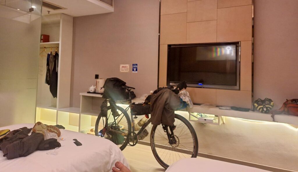
Hotels in China offer remarkable value for money. For just over $10 you can find a clean, well-equipped private room — often with breakfast included. It is one of the most affordable countries in the world for accommodation at this quality level.
Russia & Central Asia
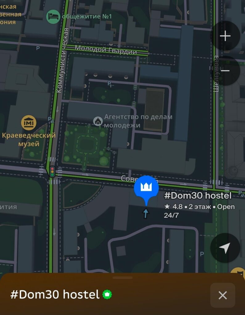
2GIS — Google Maps and OpenStreetMap are adequate for road navigation in Russia and Central Asia, but points of interest are poorly represented. 2GIS fills that gap. The app covers cities across Russia and the former Soviet states with detailed local data — shops, services and amenities that simply do not appear in western mapping apps. Worth installing as a complement to your main navigation setup when traveling through this region.